- Category: Demographics
- Published on 10 April 2006
- Hits: 17762
Town of Washburn |
|
 Surveyed by W. P. Parrott, in 1842. Settled by Nathaniel Churchill and others about 1829, incorporated February 25, 1861, and named for Governor Washburn
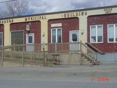
Town office location: 1287 Main Street, Washburn, Maine 04786
Phone # 207 455-8485.
Washburn, aka Salmon Brook, borders the eastern boundary of the forest that extends eighty miles westward to the border of Quebec. The fields that were cleared and cultivated reach to the New Brunswick border and to the St. John River.
The Malecite Indians were familiar with the rivers, streams and lakes. They moved from place to place depending on the need for food. In the wintertime, they lived deep in the woods, where the food was plentiful. Whether it was for food or clothing, all parts of the animal were used. Leeks and fiddleheads were in good supply along the river. The Malecite Indians were proficient in building birch bark canoes. Artifacts have been found near the Aroostook River, which happens to be the largest tributary of the St. John River.
Township 13, Range 3 was the original name for the town of Washburn. It was surveyed between 1825 and 1829. Maine became a state in 1820, but Massachusetts possessed Washburn until 1853. Woodland Township is on the northern border. Caribou and Presque Isle lyies to the east of the town; Mapleton is to the south, and Wade is to the west.
Reports showed that pine timber on the Aroostook River was superior to other places in Maine; however, the pines and the people cutting them created the problem of boundary lines, and the Aroostook War began as a result. Finally, a meeting between Lord Ashburton and Daniel Webster finalized the present boundaries. The approval of the treaty came on August 9, 1842 by Parliament and Congress.
Father LeBrun, a French missionary, was supposedly the first white person to set foot on the Aroostook soil. After the War of 1812, demand for lumber depleted the trees on the St. John and Aroostook Rivers. At first, lumbermen only spent winters cutting pine, but as they became more familiar with the area, squatter’s rights allowed claim to the property. With the settling of the boundaries, the early settlers became citizens of America, and title was given to their land as well.
The first permanent white resident of Salmon Brook was Nathaniel Churchill; he was born in Wakefield, New Brunswick. With news from lumbermen who came up the Aroostook River, he decided to go up river in his canoe along with some tools to Salmon Brook in 1824 or 1826. With the completion of his cabin and winter coming, his family joined him. The cabin became their home for five years; then they moved to Oakes Island near the Presque Isle stream. Wilder Strotton came to acquire the lot Churchill had sold to Nevers. Once again, Nathaniel Churchill moved in 1839; he moved to land that would later be called Churchill Hill.
Up to this point, all Salmon Brook settlers came from Canada. Salmon Brook settlers still used the river for transportation. Even in the year 1839 in Aroostook County, there was concern as to whether they were in Maine or New Brunswick. In 1844, two commissioners, one from Maine and one from Massachusetts, came to check settlements along the river. Each claim was thoroughly checked, and all the boundaries were marked. Many articles were written in the Maine Farmers; one of which was “The Sugar Beet is destined to become in the North, what sugar cane is to our South…” The stable crop should be wheat. Potatoes grown in this area were equal in quantity and quality of any area. Transporting the product to market was an important aspect. Work on the roads began to help with the marketing.
Charles Wilder and his brother Isaac started a new venture, which was a mill on Salmon Brook Falls. Charles O. Stoddard was first to settle in this area. Mr. Stoddard came from Perry. In 1843, one of Isaac Wilder’s brothers and Samuel Bugbee from Pembroke settled close to Stoddard. Others came and settled in this area also. Settlers came from New Brunswick and downstate Maine. Many men who showed up came as soldiers who were stationed at the blockhouses or forts in Houlton, Fort Kent and Fort Fairfield. Many stayed in the area after their active duty was up. Land policies being liberal and the down payment being only 25 cents per acre, the balance could be paid by building roads.
This settlement was organized as the Plantation of Salmon Brook in 1845. After a school was established in the home of a settler in 1848, a school was built in the vicinity of what is now Riverview Cemetery. New settlers made their home on the School Lots Road, now called Route 164. This involved over one thousand acres of land set off by Massachusetts for income, education and religious welfare.
There were other families moving into the area as well; for example, Jardine, Crouse, Whitten, Easler, Porter and Pelkey were a few of those families who moved to the town during this time, along with Smith, Umphrey, Story, Maquire, Greenleaf, Tabor and Crouse. In 1860, the census was 318 living in Salmon Brook; the population in 1870 was 449.
After the settlers got their lot, they started clearing the land. Almost everything was done by bartering. Oxen and horses were also used to help clear the land. Maple sugar was much to be desired because brown and white sugar was very scarce. There was always something to do. Winter and summer land had to be cleared; planting needed to be done; gathering sap for maple sugar was a necessity, and plowing had to be finished. They learned what crops to grow and when to grow them. Potatoes were first planted in hills among the stumps; then as time went on, the fields were opened, and the potatoes were planted in rows.
Sheep were used to produce the wool; wives cleaned and spun the wool. Strawberries, raspberries, blueberries and choke cherries were plentiful during this time. Oats were a good crop for bartering, but buckwheat was very cheap for use in trading. Flax was grown also, but it was difficult to process.
Moose, bear and partridges were abundant in the area. Hogs were killed and salted for winter use.
The first lumber camps were built up Salmon Brook. Logs could be floated down to the mill in the spring.
A blacksmith shop was started by William Smith of Pembroke in 1855. After 1858, more settlers came with the names Munsons, Kinneys, Bickfords, Rogers, Sands and Jacksons. The news stated Aroostook farmers are thriving; wheat, barley, oats, buckwheat and potatoes were excellent. Aroostook County has good soil and a healthy climate; however, the question that was asked by everyone was 'could a rail be opened from Bangor to Aroostook County?'
Salmon Brook was incorporated in 1861, and it was named Washburn after Governor Israel Washburn. This name had various spellings: Washbourne, Wasseburn and Washburn. A relative of Sir Roger came to Plymouth Colony in 1631. After moving to Livermore Falls in 1809, Israel came to Orono in 1831 to study law. He practiced in Orono until in 1851, the year he was elected to Congress. Township 13 was organized as Gardiner Brook Plantation in 1849. They lost their organization in 1852, but they regained it under the name Wade in 1874. The township was named Dunn Town because much of the land was owned by the Dunn family. Township 14 became the town of Perham.
During the Civil War, manpower was sacrificed in Washburn. Some of them volunteered to go; some of them were drafted, and others arranged for a substitute to go in their place. During this time, some died from diseases, and wounds were suffered during this time as well.
Washburn lost their library to a fire in 1864. It had been presented to the town by Governor Washburn. The mill and many buildings were lost.
The barn sizes increased as the crops increased. When everything was ready, neighbors came with their families and spent, what was called, raising-day building the barn. Everyone, including the wives, had a job. A good time was had by all, including the children. Friendships were renewed, and news was up-dated.
By 1875, a starch factory was built. This gave those producing potatoes an incentive.
The blacksmith shop was a busy place for repairs and congregating.
Potato acreage increased during the time period of 1869-89; potatoes were picked in ash baskets, which were supplied by the Indians.
Rail transportation improved the marketing of potatoes, and it increased the number of acres for the potato crop. The farmers and farmer’s wives worked very long days.
The first schoolhouse was built in 1848. The first high school class graduated in 1907. Renewed education seemed to occur with the two railroads coming in 1910. The first school bus was purchased in 1941, the year the Everett school was eliminated to complete consolidation. By 1945, many of the retirees were recalled because of the lack of teachers, and salaries gradually increased after the war. The school gradually became enlarged over the years. In 1957, there was a growing concern to form a school administrative district, which would include Washburn, Mapleton, Castle Hill, Wade, Perham and Chapman. By 1958, it was implemented; however, parents were concerned of the expense, distance in traveling and location of the school. As a result, the district was dissolved in 1961, and Washburn was on it’s own once again.
Crouseville became a separate village within the township. There were discussions as to if it should be called Crouseville or Churchill; both families were well represented.
The town band was formed under the direction of Nathan Allen in 1888. Music was provided for celebrations and concerts at the band stand.
Early religious training was conducted by Deacon S.W. Tabor from South China, Maine. He started Sunday schools in different areas of Washburn. Several different churches came into being; the different types of churches include the following: Baptist, Advent, Methodist, Catholic, Pentecostal and other churches as well.
The A.V.R.R. and the Bangor and Aroostook Railroad's passenger and freight schedules helped to develop Washburn.
In 1911, the Aroostook Trust Company opened a bank in this area; it was an area that consisted of three automobiles and 133 carriages. The bank was opened in the Ed Hines building. In 1914, the Washburn Record, which was a newspaper that was published weekly, was started. The price of potatoes was good in 1918. When President Roosevelt closed the banks in 1933, this disrupted business. Washburn Trust Company was able to reopen soon after and did not go insolvent like many of the other banks.
In 1941, a dehydrating plant was established and received the government “A” award for excellence. In 1946, the plant was changed from a dehydrating plant to a frozen foods plant. The plant was renamed Taterstate Products Division of Aroostook Potato Growers, Inc., and production of French fries increased as a result. Washburn was the first town to produce frozen potato products in Aroostook County. Eventually in 1966, Agway, Inc. and Maine Potato Growers, Inc. resumed management of this plant for eight years; then, it was sold to McCain’s Ltd. of New Brunswick. One of Washburn’s largest acreage was in 1945.
The Salmon Brook Historical Society has two different museums, and they are the Benjamin C. Wilder Farmstead and the Aroostook Agricultural Museum.
 The 1852 Benjamin C. Wilder home was purchased in 1985. This home was entered on the National Register of Historical Places in the State of Maine by the Maine Historical Preservation Commission and the Department of the Interior of Washington. D.C. It shows an excellent example of a farmstead during this period. Furniture and appliances are typical of the era. The barn was replaced in 1989 because the original was destroyed in a fire in 1938. The barn houses antique machinery, sleighs, surrey, pottery and many wooden planes and tools. The museums are a must see if you want to appreciate how beautiful it looks.
The museums are located on 17 Main Street, Washburn, Maine 04786. For more information, call (207) 455-4339.


 Central Aroostook Chamber of Commerce
 Washburn